Alewife-Ashmont
MBTA Red Line, 11.5 Miles

MBTA Red Line, 2.54 Miles

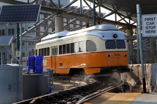
The current trolleys used on the line are PCC streetcars built in the 1940s, though the MBTA is considering moving some older trolleys from the Green Line to the Mattapan Line once the Type 10 trolleys are delivered. If this were to be done however, the T would have to rebuild bridges to support the weight, modify either the pantographs on the trains or the overhead lines themselves along with more work
MBTA Green Line B, 4.2 Miles (branch only)

The Green Line A branch was a former branch that ran on the B line until Packards Corner, before splitting off the B line and running to Watertown. The A branch was abandoned in 1969, being replaced by the Route 57 bus
MBTA Green Line C, 2.9 Miles (branch only)

Cleveland Circle used to be called Reservoir, the same name of a nearby stop on the D branch. Existing tracks make a connection between Chestnut Hill Avenue (B), Cleveland Circle, Reservoir (D) and the Reservoir Yard
MBTA Green Line D, 9.7 Miles (branch only)

Although one track has two platforms making it possible to board/alight on both sides, operators only open doors on the right due to the absense of a camera and moniter to safely view the doors on the left side (a mirror is attached to the right side door, so a moniter is not needed there)
MBTA Green Line E, 2.6 Miles (branch only)
Fun Fact: Even though there is a covered waiting area on the left platform, passengers are supposed to wait on the sidewalk to the right. Drivers usually open the doors on both sides though
MBTA Blue Line, 6 Miles

Airport is the point where Blue Line trains switch power modes. If you look to the roof of a train as a train is boarding, you can see the pantograph raise or lower depending on which direction it is headed
*Eastbound terminals are subject to change, both temporarilly and permanently
**Trains may terminate and originate at Reservoir to access the Reservoir Yard
***Some trains short-turn at Brigham Circle when major traffic is present or there is an accident on the Brigham Circle-Heath Street Line. Use Route 39 for alternative service